Most visitors experience Menorca as a collection of places.
A beach in the morning. A lighthouse at sunset. Lunch in a fishing village. A hidden cove discovered through a recommendation or social media post.
The island is experienced as a sequence of highlights.
The Camí de Cavalls offers something entirely different.
Rather than presenting Menorca as a series of destinations, the island’s historic coastal path reveals it as a connected system. Walk enough of the Camí and a striking realisation emerges: the route is not simply a way of seeing Menorca. It is one of the best ways of understanding it.
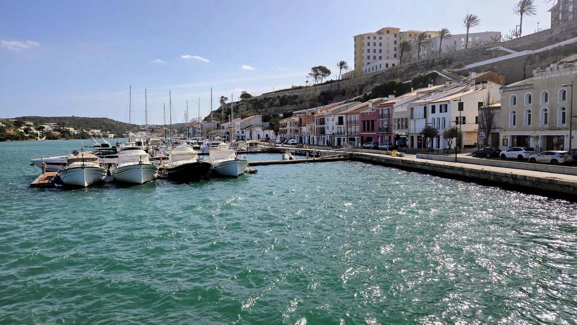
Stretching for approximately 185 kilometres around the entire coastline, the Camí de Cavalls passes through every municipality, every major coastal landscape, significant archaeological zones, defensive structures, wetlands, forests, cliffs and beaches. It is one of the few places where the island can be experienced as a continuous whole rather than as a series of isolated attractions.
Quick Answer: What Does the Camí de Cavalls Reveal About Menorca?
The Camí de Cavalls reveals Menorca as a connected island system rather than a collection of separate beaches and attractions. The 185-kilometre coastal route shows how Menorca is shaped by geology, wind, history, ecology and human adaptation, especially through the contrast between the exposed northern Tramuntana and the sheltered southern Migjorn.
Quick Facts About the Camí de Cavalls
Length: Approximately 185 kilometres
Route type: Circular coastal trail around Menorca
Official route: GR223
Number of stages: 20
Best for: Walking, hiking, landscape interpretation and understanding Menorca’s coastline
Key landscapes: Cliffs, coves, wetlands, pine forests, ravines, lighthouses and dry-stone landscapes
Historical role: Coastal surveillance, communication and defence
A Route Shaped by Necessity
The origins of the Camí de Cavalls remain debated.
Some accounts connect the route to medieval royal orders requiring mounted patrols to monitor the coastline. Others point to later military administrations, including periods of French and British control.
What is certain is its function.
The Camí de Cavalls operated as a coastal surveillance and communication route, linking vulnerable stretches of shoreline and strategic defensive positions. For centuries, Menorca’s coastline was something that needed to be watched, crossed and understood. The path is the physical expression of that need.
This is why the route feels fundamentally different from modern walking trails.
Most are designed around scenery.
The Camí was shaped by geography.
Its line follows the realities of the island itself: the coastline, the position of natural harbours, the placement of defensive structures and the practical demands of movement across exposed terrain.
It is less a trail than a record of how Menorca has historically been read.
The Island Begins to Organise Itself
What makes the Camí de Cavalls remarkable is not simply where it goes, but what it reveals.
A visitor travelling by car experiences the island through substitution.
One beach replaces another. One village follows the next.
The Camí creates a fundamentally different experience because it enforces continuity.
The landscape changes gradually. Patterns emerge. Contrasts repeat.
Walking from the north coast to the south coast reveals structure rather than variation.
The northern half feels exposed.
The south feels sheltered.
The north opens outward.
The south folds inward.
The pattern is consistent, not occasional.
What initially appears as a collection of beautiful locations begins to resolve into something more coherent.
Menorca starts to make sense.
Not as variation, but as structure.
The Geography Behind the Contrast
Menorca is structurally divided into two regions.
The northern Tramuntana consists of older, fractured formations shaped by geological complexity. The result is a rugged landscape of exposed cliffs, irregular terrain and persistent interaction between land and sea.
The southern Migjorn presents a different condition.
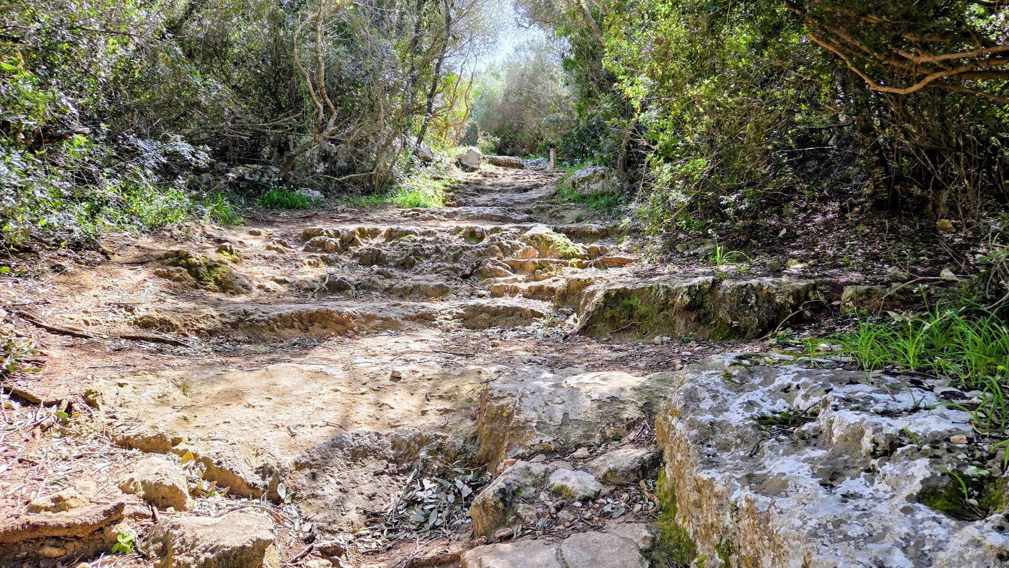
A broad limestone platform slopes towards the coastline, cut by ravines that create many of the island’s most recognisable coves. These ravines retain moisture, shelter vegetation and produce distinct microclimates.
The Camí de Cavalls makes this transition visible.
On northern sections around Favàritx, Cavalleria and Punta Nati, the landscape is reduced to its structural core. Vegetation thins. Stone dominates. The wind remains present.
Further south, the route enters shaded valleys, pine woodland and enclosed terrain where the environment shifts towards protection and stability.
The island’s beauty stops feeling accidental.
It becomes inevitable.
A Landscape Built Through Adaptation
The Camí reveals something deeper than scenery.
Menorca is not simply a natural landscape.
It is a landscape built through adaptation.
Dry-stone walls, which accompany the path across large sections of the island, are among the clearest examples. They were not built as decoration, but as responses to terrain, wind and agricultural need.
They protect crops.
Control erosion.
Provide shelter.
Define boundaries.
Guide movement.
This relationship extends far beyond the modern landscape.
Talayotic Menorca demonstrates how earlier communities organised themselves through visibility, structure and resource management. Settlement patterns, stone construction and land use all reflect the same interaction between environment and response.
The Camí de Cavalls is part of that story.
Nothing on the island exists outside that relationship.
Access Without Domination
The Camí de Cavalls opens the island without fully domesticating it.
It provides access, but it does not simplify.
Protected areas remain protected.
Agricultural land is still in use.
Weather continues to dictate conditions.
Sections require maintenance. Some become temporarily inaccessible.
The island retains its limits.
This is why the route feels different.
A cove feels secluded because access is genuinely difficult.
An open plateau feels empty because environmental conditions limit what can exist there.
The Camí does not remove these constraints.
It keeps them visible.
The Island Beneath the Postcard
Menorca is often presented through surfaces.
Turquoise water.
White sand.
Hidden coves.
Golden light.
These things are real.
They are not the explanation.
The Camí de Cavalls reveals the structure beneath them.
It shows that the island is organised by exposure and shelter, geology and ecology, movement and access.
What appears as variation becomes pattern.
What feels intuitive becomes legible.
The path does not tell you where to go.
It shows you how the island works.
Quick Facts About the Camí de Cavalls
What is the Camí de Cavalls?
The Camí de Cavalls is a historic 185-kilometre coastal path that circles the entire island of Menorca, connecting beaches, cliffs, wetlands, lighthouses, archaeological sites and all eight municipalities.
Why is the Camí de Cavalls important?
The route is one of Menorca’s most significant cultural and historical assets. Originally used for coastal surveillance and communication, it now provides public access to the island’s diverse landscapes while preserving an important part of Menorca’s heritage.
How long does it take to walk the Camí de Cavalls?
Walking the entire route typically takes between 7 and 10 days, depending on pace, weather conditions and the number of stages completed each day.
Can you walk the entire Camí de Cavalls?
Yes. The route forms a complete circuit around Menorca and is divided into 20 official stages. Walkers can complete individual sections or undertake the entire trail.
What makes the Camí de Cavalls unique?
Unlike most coastal trails, the Camí de Cavalls reveals the complete structure of Menorca. It passes through the island’s contrasting northern and southern landscapes, exposing how geology, climate, history and human settlement have shaped Menorca over centuries.
Which are the most scenic sections of the Camí de Cavalls?
Popular stretches include Favàritx Lighthouse, Cavalleria, Cala Pregonda, Punta Nati, Cala Galdana, Binigaus and the protected landscapes surrounding S’Albufera des Grau Natural Park.
Is the Camí de Cavalls suitable for beginners?
Many stages are accessible to casual walkers, although some northern sections involve rough terrain, exposed conditions and significant elevation changes.
Why does the Camí de Cavalls explain Menorca?
Because it connects every major landscape on the island in one continuous route. Walking the trail reveals patterns that are difficult to see when travelling by car, including the contrast between the rugged Tramuntana north and the sheltered Migjorn south.